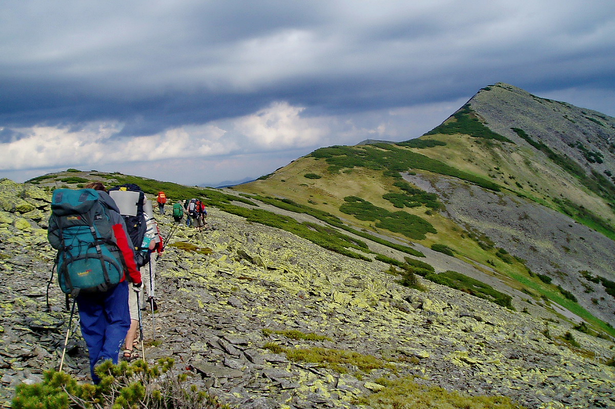
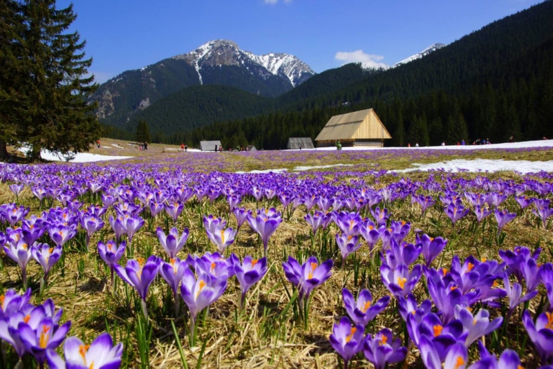
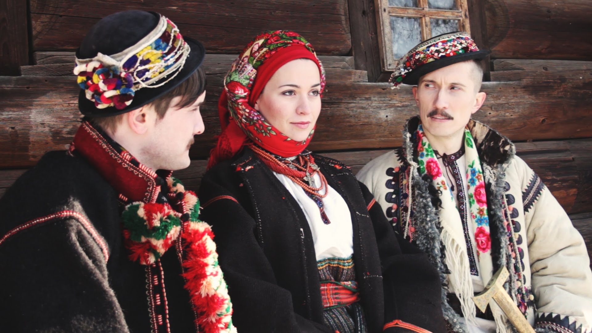
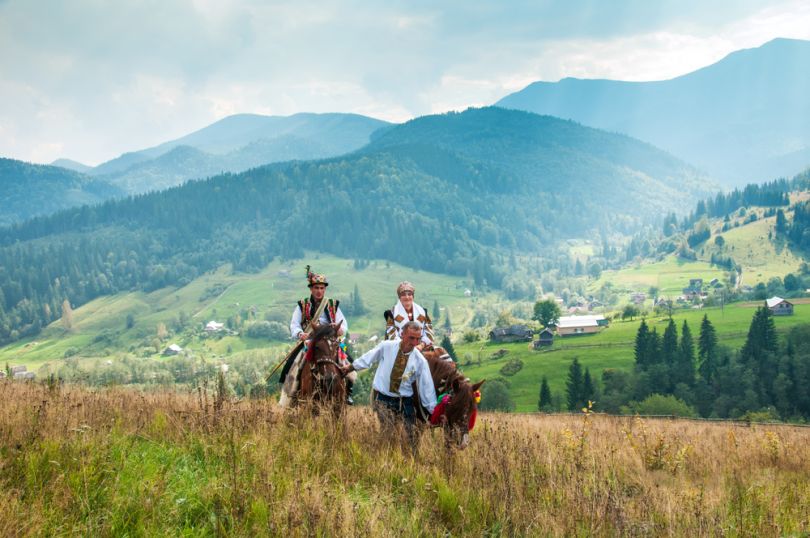
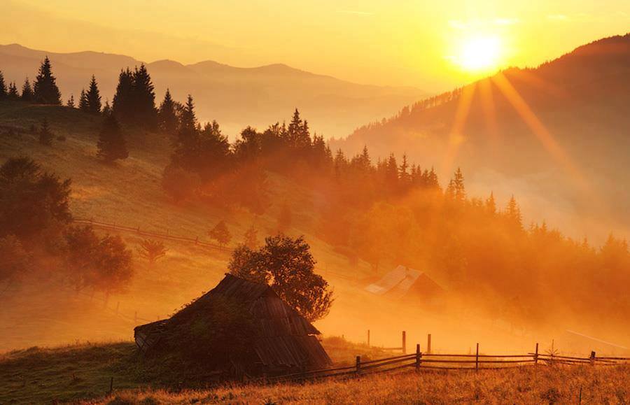
This is the land of the Hutsuls, Boykos, Lemkos and other native ethnical groups whose colorful folk culture is laced through thin villages stretching languidly along wide valley floors. These are the highest and most picturesque mountain peaks of Ukraine. Carpathian Mountains are the epicenter of Ukraine’s rural folk culture as well as the number one holiday destination for numerous Ukrainians and international travelers. The local peaks are very popular with hikers and skiers.
Geography
 The Carpathians are a crescent-shaped mountain system that was formed by the same forces that lifted the higher Alps to the west. A mountain range system with an arc shape is roughly 1,500 km long and stretches across the Central and Eastern Europe. The Carpathians go through Czech Republic, Slovakia, Poland, Hungary, Ukraine, Serbia, and Romania, making it the second-longest mountain range in Europe. The mountains begin as a range of low hills near Bratislava, Slovakia, reach their highest point in Slovakia's High Tatras (Gerlachovský peak at 2655 m), and continue arching eastward into Ukraine before turning south and bending through Romania, where they reach another high point (Moldoveanu, 2543 m.) and then fade into the plains.
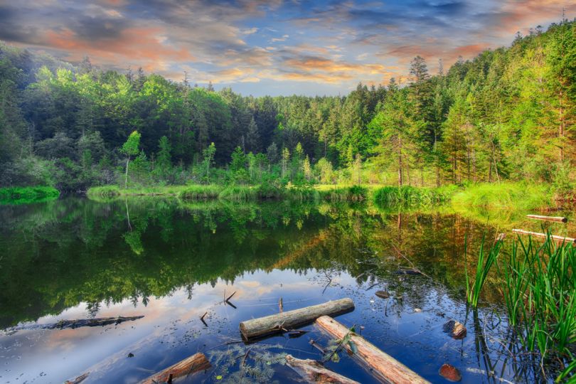
The Ukrainian Carpathians are gentle peaks that rise as high as 2061 m. The higher peaks experienced some glaciation during the last Ice Age, and there are even a number of small tarns above 1700 meters and a spectacular lake Sinevyr at 1000 m.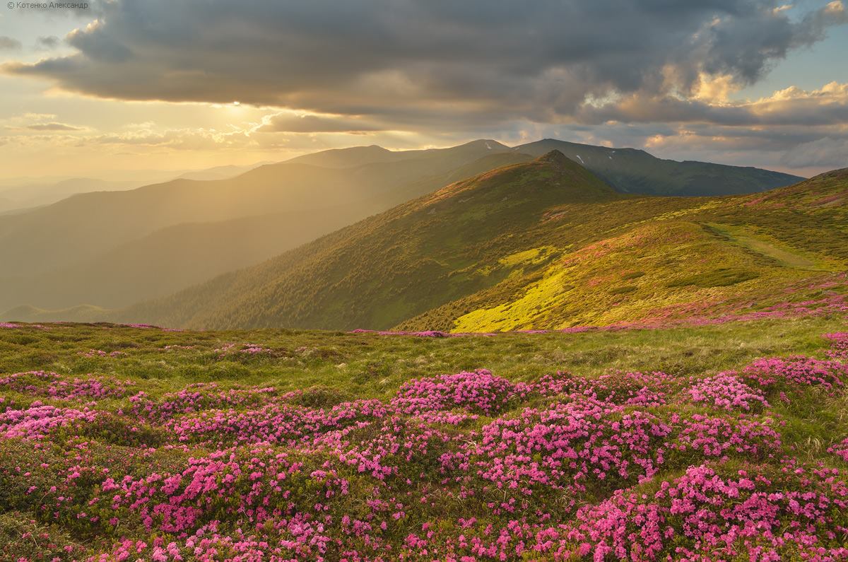 Carpathian Mountains in Ukraine have a relatively mild temperate climate. Winter temperatures may get down to -10 or -15° C (5 to 14° F), but not much colder than that. Winters and autumns are usually very snowy and rainy. The Carpathians are moist mountains with between 800 and 1600 mm (31 to 58 inches) of precipitation spread quite evenly throughout the year. Summers are warm with frequent rain and thunderstorms. The tree line is around 1500-1800 m. above sea level. Ukrainian Carpathians are typical mountains of medium height with rock of low resistance. Gentle, broad, and little-dissected ridges and parallel valleys contrast with the deeply incised (up to 1,000 m) transverse valleys with steep slopes that are the result of the relief's rejuvenation. Only the highest parts of the Carpathians — mainly the Hutsul Alps and Chornohora — display a high-mountain landscape owing to past glaciation. Rock fields appear only here and in the Gorgany Mountains, but even the highest peaks of the Carpathians are covered with clays and continuous vegetation.
Famous Peaks
Hoverla
 Hoverla is the highest point of Ukraine, situated on the border of Ivano-Frankivsk and Zakarpattia regions on Chornohora mountain group. It has a cone form and is covered by Alpine meadows and dwarf shrub heath. At the bottom of mountain lies a waterfall and one of the sources of the river Prut. It is popular place for summer and winter tourism. In winter time the summit is classified as сlimbing 1A: Hoverla (sometimes written "Goverla") is not a difficult mountain to climb. The most popular route is from the east — a mere 6 km climb from the trailhead at 1100 m above sea level (Zaroslyak mountain cottage) to the summit at 2061 m. Petros (2020 m) is one of the highest summits of Chornohora mountain range, located on the north-west end of the range between Sheshul and Hoverla mountains in Rakhiv district, Zakarpattia region. West and east sides are arduous with many stones, north and north-east sides are scarp with crags. There are a lot of bushes (low juniper, rhododendron), blueberry brakes and spruce forest (bellow 1530-1600 m). Sometimes there are avalanches in winter. Tourist shelter is situated on the south sides below Rogneska subalpine meadow.
Pip Ivan
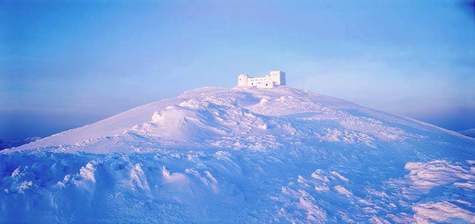 Pip Ivan («Peak Ivan» in Ukrainian) Chornohora is part of the Carpathians ranges and, with an elevation of 6,634 feet above sea level, it is the third highest peak in the country. The mountain was a center of contention from 1918 until 1939 when the Polish border troops made an offensive attack and took over the area. The Polish government built up an impressive astronomical and meteorological observatory center at the summit of this mountain. Nowadays the observatory center is ruined. This mountain is a major tourist attraction site especially for nature lovers. There are several historical and architectural monuments as well as beautiful alpine meadows and woods. Temperatures in the Pip Ivan are not extremely low, and the lowest ever recorded temperature is 5 degrees. Common activities in the mountain for the visitors are cycling, riding, hiking and rating.
Hutyn Tomnatyk
Hutyn Tomnatyk is one of the highest mountains in Ukraine (2,016 m or 6,614 ft). It is located in Rakhiv district of Zakarpattia region within the Carpathian Biosphere Reserve (Chornohirskyi protected massif). The name comes from the old word «oszteto», which means «gray top». The mountain slopes are covered with subalpine and alpine meadows, many of the local species are extremely rare. Lake Brebeneskul is situated at 1,801 m (5,909 ft) in the north-eastern slope between Hutyn Tomnatyk and Brebeneskul mountains.
National Parks
Carpathian National Natural Park
 The Carpathian National Natural Park created in 1980 to protect the unique natural riches of the Carpathian Mountains. Majestic mountains, picturesque valleys, mountain pastures, crystal lakes, pure rivers, healing springs, valuable monuments of archeology, history and architecture - all of it make the Carpathian Natural Park desirable to many travelers from all over the world. Located in the mountains of the Prut River basin, the park occupies a territory of over 50 thousand hectares. It amazes not only with its fantastic landscapes and unforgettable scenery, but also with the variety of its flora and fauna. A large number of various plants that grow in the park are on the endangered species list. Moreover, almost 200 species of animals and birds live here. The park has several dozen trails; however, not all of them are adequately marked, and, therefore, it is best to tour or hike the mountains with a local resident or with a guide from a special excursion, which you can book in advance at a tourism agency. You can get to the park through special checkpoints, located in the surrounding towns and villages. People frequently come to the reserve from Yaremche, Vorokhta, Bukovel, and Verkhovyna. The office of the Carpathian National Park is located in Yaremche town, at. Stusa str, 6. There is also an eco-tour center in the same building, where you can find out information about the reserve. You must pay the price of admission at the park entrance checkpoints.
Skole Beskids National Park
 Skole Beskids National Park is another top attraction of the country located in the most picturesque part of the Carpathians. It covers most of the Skole district and some neighboring areas of Lviv region. Skole Beskids National Park is one of the most beautiful and therefore frequented by tourists places in Ukraine. Balneological resorts Skhidnytsia, Skole, Slavske are located on the territory of the national park. The park is located in the valleys of Striy and Opir rivers, and there is a good opportunity for boating, rafting and even sailing. This area also boasts most popular ski resorts in Ukraine. On the territory of the park one can still find the remains of pure beech forests and spruce fir forest stands, the totality of which occupies the highest position in the park's relief. The age of trees is more than 100 years here. On some ridges there are rare beech, sycamore and alder forests with a medicinal plants cover (for instance, rare ramsons or henbane bell). In general, vascular flora consists of 632 species. More than 50 plant species of the park are listed in the Red Book of Ukraine: leopard's bane, great masterwort, Northern firmoss, fragrant orchid, Narrow-leaved Helleborine, Red Helleborine, creeping lady's-tresses, Lesser Twayblade, Turk's cap lily, perennial honesty, lesser butterfly-orchid, common snowdrop, autumn crocus, small white orchid, henbane bell, the Round Headed Orchid, Crocus heuffelianus Herb, several species of marsh orchid. The fauna of Skole Beskids National Park is rich and diverse.
Population
 The Carpathians and Transcarpathian region (everything west of the main ridge of the Carpathians) are quite interesting culturally and historically due to a mixture of ethnic groups and historical ties.
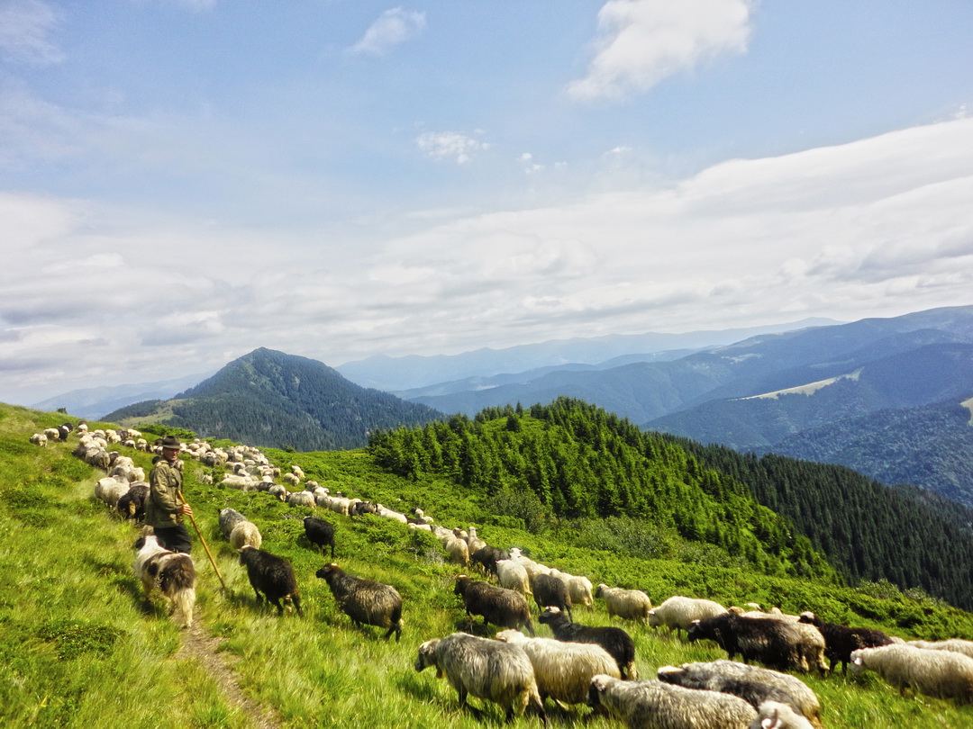
Ukrainian highlanders are divided into several ethnographic groups: Hutsuls, Boykos, Lemkos and other smaller ones. The Lemkos inhabited the Low Beskyd and the western part of the Middle Beskyd (almost all of them were resettled by the Polish authorities); the Boikos lived up to the Bystrytsia Solotvynska River in the east; and the Hutsuls resided in the east. The central part of Transcarpathia is settled by the Zahoriany (tramontanes) or Dolyniany (lowlanders), who are related to the Boikos and speak a central Transcarpathian dialect.
There are two forms of settlement and farming in the Carpathians and they appear to be independent of the natural environment. The first is the Hutsul form and the second is practiced by all other highlanders. The Lemkos, Boikos, and Zahoriany are basically agricultural people. They cleared the forests to obtain arable land and built their elongated villages in the valleys. Their settlements are at low altitudes. The basic occupation of the Hutsuls is animal husbandry, their land is used for pastures and hayfields. Hutsul homesteads are attached to their fields; hence, their settlements are scattered and extend to considerable altitudes.
Attractions
Dzembronia Village
 To discover authentic rural life of the Carpathian region, many travelers visit highland villages and small towns, where the traditions and rituals are very well preserved till our days. Dzembronia is a small village located on the steep slopes of Chornohora Ridge in Verkhovyna district of Ivano-Frankivsk region, near the border with Romania. It is the most high-altitude village in Ukraine and probably one of the most picturesque ones. The population of Dzembronia is only about 250 people.
Kolochava
 Another popular travel destination is Kolochava village. This is a small picturesque mountain village located in the very heart of Carpathian Mountains in Ukraine. This is a very popular recreational destination, which offers fresh mountain air, breathtaking views, mineral water springs and impressively well-preserved culture and traditions of the region. Kolochava is often referred to as a museum-village. Here travelers can discover the genuine lifestyle of Carpathian ethnical groups.
Skiing
Many local and foreign travelers associate Carpathian Mountains with skiing and snowboarding. Indeed, Carpathian Mountains recently have become a winter sports mecca for many Ukrainians and guests from abroad. The most popular ski resort in Ukraine is «Bukovel». However, there are many other less known ski areas, which can pleasantly surprise its guests with high service, good equipment and lower prices for ski-passes and accommodation: Kosiv region, Sheshory, Verhovyna, Yablunytsya, «Play» ski resort, Drahobrat, Pylypets and others. All of them are scattered around Ivano Frankivsk region. Many of these ski areas boast great selection of affordable accommodation options and newly constructed ski lifts.
Carpathian Mountains in Ukraine are a must-visit travel destination of the country. This area will fascinate you with its beauty regardless the time of year and weather. It is a perfect travel option for active leisure as well as for the romantic and relaxing getaway.
Photo sources: moemisto.ua, karpaty.life, ukrainetrek.com, karpatnews.in.ua, zruchno.travel, shutterstock.com, dreem-pics.com, foto-basa.com, amazing-ukraine.com, firtka.if.ua. All images belong to their rightful authors.